Walking Path Along Ohře River Karlovy Vary Map and Checklist
Exploring the Ohře River is a highlight for any visitor to West Bohemia. Having a clear walking path along Ohře River Karlovy Vary map ensures you don't miss the best views. This path offers a peaceful escape from the busy spa colonnades. You will find lush forests and dramatic rock formations along the way. This guide provides actionable checklists to help you navigate the route with ease.
Essential Before You Go Checklist
Preparation is the key to an enjoyable outdoor experience in the Czech Republic. Before you leave your hotel, ensure you have the right digital tools. The river path can sometimes have spotty mobile reception in deep valleys. Download an offline version of your map to stay on track. You should also check the local forecast on the Karlovy Vary Official Tourism website for any weather warnings.
- Download maps: Save an offline walking path along Ohře River Karlovy Vary map on your phone.
- Check weather: Look for rain or high wind alerts that might affect river paths.
- Transport check: Verify return train times from nearby villages like Loket or Doubí.
- Notify someone: Tell your hotel staff or a friend about your planned route.
- Charge devices: Ensure your phone is at 100% to support GPS tracking throughout the day.
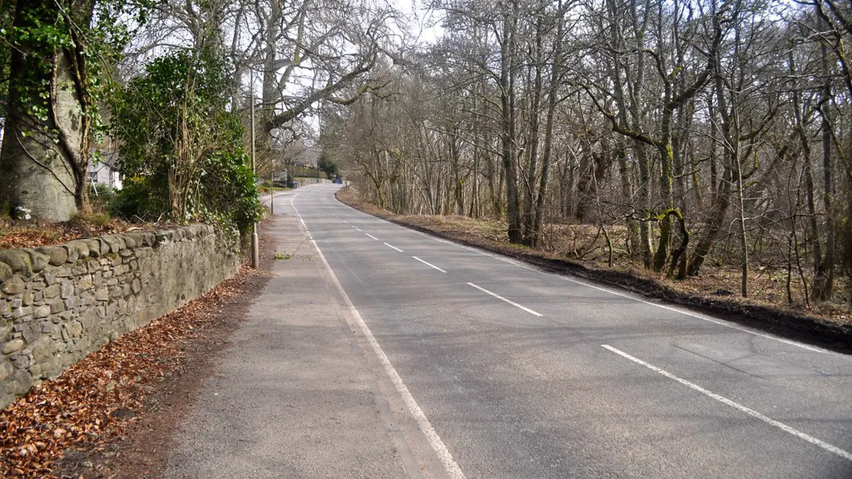
Navigating the Walking Path Along Ohře River Karlovy Vary Map
The route typically begins near the main bus or train station. Following the Ohře River scenic walk allows you to see the city from a new perspective. Most paths are well-marked with color-coded signs on trees and poles. Look for the blue or red markers that lead toward the Svatoš Rocks. This section is mostly flat and suitable for most fitness levels.
If you prefer a faster pace, you might consider the cycling route from Karlovy Vary to Loket which runs parallel. The walking path stays closer to the water's edge for better photos. Many hikers enjoy the section that passes through the Doubí neighborhood. Here, the trail enters a more forested and quiet environment. It is one of the best quiet places in Karlovy Vary for nature lovers.
On the Day Checklist: What to Bring
Packing the right gear makes your walk more comfortable and safe. Even a short walk requires basic supplies like water and sun protection. The trail features several rest areas, but shops are rare once you leave the city. Use this list to pack your day bag efficiently. Remember that the temperature near the water can be cooler than in the city center.
- Water bottle: Carry at least 1.5 liters of water per person.
- Footwear: Wear broken-in walking shoes or light hiking boots with good grip.
- Power bank: Bring a portable charger to keep your map active.
- Snacks: Pack energy bars, nuts, or fruit for a quick boost.
- Sun protection: Apply sunscreen and wear a hat, even on cloudy days.
- Light jacket: Bring a windbreaker for the shaded sections of the river valley.
If You Are a Solo Traveler: Safety Checklist
Solo walking is a great way to enjoy the Karlovy Vary spa woods trails and river paths. However, safety should always be your top priority when venturing out alone. The Ohře River path is generally safe and popular with locals. Still, it is wise to follow a few simple rules to stay secure. Always stay on the marked trails to avoid getting lost in the dense woods.
- Live location: Share your real-time location with a trusted contact via your phone.
- Emergency numbers: Save the local emergency number (112) in your contacts list.
- Daylight hours: Start your walk early to ensure you finish before sunset.
- Whistle: Carry a small safety whistle in your pocket for emergencies.
- Local transport: Keep a copy of the Dopravní podnik Karlovy Vary schedule for local buses.
Common Mistakes to Avoid on the Trail
Many visitors make simple errors that can lead to a stressful day. Avoiding these common pitfalls will help you enjoy the scenery without distraction. One major mistake is failing to check the distance before starting. The walk to Loket can take several hours depending on your pace. Always keep an eye on your walking path along Ohře River Karlovy Vary map to monitor your progress.
- Ignoring markers: Do not deviate from the marked blue or red trails.
- Wrong shoes: Avoid wearing flip-flops or high heels on the gravel paths.
- Late starts: Don't begin a long walk late in the afternoon.
- Forgetting water: Never assume there will be a cafe around every corner.
- Phone battery: Don't use your phone for music if it drains your navigation battery.
- Littering: Always carry your trash back to the city bins.
- Overestimating fitness: Take breaks often to avoid exhaustion.
Don't Pack These Items
Keeping your bag light will make the journey much more pleasant. You do not need heavy equipment for this specific river trail. The path is well-maintained and does not require professional mountaineering gear. Focus on the essentials and leave the heavy items at your accommodation. This helps you maintain a steady pace and reduces back strain.
- Heavy books: Use digital guides instead of thick paper books.
- Large umbrellas: A lightweight raincoat is much more practical for walking.
- Valuables: Leave expensive jewelry and large amounts of cash in your hotel safe.
- Formal clothing: Stick to athletic or outdoor wear for maximum comfort.
- Bulky cameras: A smartphone or a small mirrorless camera is usually enough.
Frequently Asked Questions
Where can I find a walking path along Ohře River Karlovy Vary map?
You can find digital maps on the official Karlovy Vary tourism website or use mobile apps like Mapy.cz. These maps show the detailed trail from the city center toward the Svatoš Rocks and Loket. Physical maps are also available at the local tourist information centers near the colonnades.
How long does it take to walk the Ohře River path?
The walk from Karlovy Vary to the Svatoš Rocks takes about 1.5 to 2 hours. If you continue all the way to the town of Loket, plan for a 3 to 4-hour journey. The total distance is approximately 10 to 12 kilometers depending on your exact starting point.
Is the Ohře River walking path suitable for children?
Yes, the path is mostly flat and paved or covered in fine gravel, making it ideal for families. It is stroller-friendly in most sections, especially between Karlovy Vary and the Doubí area. Children will enjoy seeing the ducks and the dramatic rock formations along the water.
Walking along the Ohře River is a refreshing way to experience the natural beauty of Karlovy Vary. By using a walking path along Ohře River Karlovy Vary map and following our checklists, you are ready for a great adventure. Whether you are looking for a short stroll or a long hike to Loket, this route never disappoints. Don't forget to pack your camera and enjoy the serene landscape of West Bohemia.
Official resources
Use these sources for official schedules, tickets, routes, and updates.
- Karlovy Vary Official Tourism — unverified: Official DMO site.
- Statutory City of Karlovy Vary — unverified: Official municipal portal.
- Visit Czechia — unverified: National tourism board.
- UNESCO World Heritage Centre — unverified: Official UNESCO listing for the city.
- Lonely Planet Karlovy Vary — unverified: Tier 3 editorial requirement.